Read the labels before the colors
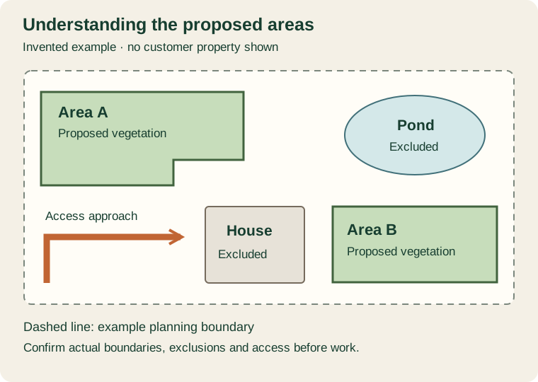
In the example, Area A and Area B represent separate vegetation areas proposed for review. The building and pond are excluded from the proposed application. The access line shows an approach for planning discussion, not a guarantee that equipment can use it. Labels matter because colors alone can be ambiguous when a map is printed or shared.
Confirm boundaries on the actual property
Use familiar landmarks and current photos to resolve uncertain edges. A parcel boundary is different from a treatment boundary, and a mapped area does not authorize work on neighboring land. If a fence, water feature or planting bed is missing from the drawing, have it added or clearly described before treating the scope as final.
Connect the map to the price
Ask which labeled areas are included, how area estimates were determined and whether alternatives are priced separately. Do not assume an outlined parcel means the whole parcel will be treated. If preparation changes the vegetation or footprint, request an updated scope so the map and proposal continue to describe the same service.
Keep the agreed version
Record the map date or version and retain it with the written proposal. Completion information should explain material differences from the planned work. Start a WTG quote request with an address and photos; you can provide an existing sketch, but you do not need a professionally drawn map to begin the discussion.